Geospatial Data
Buy highly accurate geospatial data from 341.897.577 businesses worldwide. Geospatial data is data about objects, events, or phenomena that have a location on the surface of the earth. It's mostly used for apps, systems, mapping and utilize geomarketing campaigns.
It’s important to have the exact location of your customers and prospect. Often a postal address is just not enough, because many countries don’t have a standardized postal code system. By using our geospatial database with 300 million+ companies you can locate companies by razor sharp precision by latitude and longitude. Our highly accurate Geospatial data is used for all purposes: from building your app or route optimization system to geo-marketing campaigns with extreme precision.
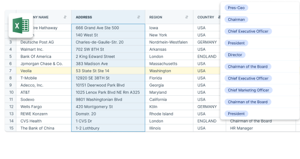
Buy Customized Geospatial Data Database in Excel
We guarantee the best coverage in 200+ countries from local sources such as Chambers of Commerce, Statistics Offices, and Trade Associations. Each Geospatial Data Database we supply can be filtered by country, number of employees, and industry. Based on your input, our data experts will create a custom Excel list tailored to your needs. Simply request a quote by filling in the contact form.
Biggest Geospatial Database Companies Worldwide
The top three geospatial database companies globally are Esri, Hexagon AB, and Trimble, with Esri leading in revenue.
- Esri – USA
- Hexagon AB – Sweden
- Trimble – USA
- Autodesk – USA
- HERE Technologies – Netherlands
- Bentley Systems – USA
- Maxar Technologies – USA
- CARTO – Spain
- Google Earth Engine – USA
- GeoIQ – USA
This Top 10 Geospatial Data is selected from our global database based on (modeled) revenue and/or number of employees. Company Data from all Geospatial Data companies in the world is available in Excel, Bulk Dataset or API and can be tailored to your needs by our data experts. Ask a quote via the contact form and buy your custom-made list today!
Tell us which regions you need
Our team of data experts take the time to understand your business, target group and campaign. Based on these insights we create a highly targeted geospatial database based on more than 10.000 criteria and 200 Geospatial Data. From country, city and number of employees to industry type and revenue.
Get a quick count of your Geospatial database
You’ll get free quote and a detailed count of your Geospatial database within 24 hours. On request we can provide a free sample with a selection of 10 records. Based on your feedback we polish the Geospatial data to perfection.
Geospatial data delivery in 24 hours
Satisfied and want to launch your campaign? Then we deliver the Geospatial data in Excel /CSV within 24 hours. And you can start your marketing efforts with uttermost effectiveness.
Which Geospatial Data can BoldData deliver?
| Longitude | 167119294 |
| Latitude | 167119294 |
| GeoLevel | 167105510 |
| GeoConfidence | 125476654 |
| Geo positioning code | 34309765 |
| Geo positioning code | 9226782 |
| Level of geocoding 1 = town, 2 = street, 3 = block | 3745030 |
| score comparison between adres and geocoding (0,00 lowest level to 1,00 best level) | 1093733 |
| Address1 | 166773309 |
| Address2 | 73003112 |
| AddressStreet | 165140657 |
| AddressHouseNumber | 142585137 |
| PostCode | 161568704 |
| City | 169080747 |
| Province | 153623456 |
| Country | 173911493 |
| Language | 173701662 |
| Phone | 74428804 |
| Fax | 15585980 |
| Mobile | 13394212 |
| Website | 16426096 |
| 9031276 | |
| NationalID | 95964334 |
What is Geospatial data?
Geospatial data is data about objects, events, or phenomena that have a location on the surface of the earth. The location may be static in the short-term (e.g., the location of a road, an earthquake event, children living in poverty), or dynamic (e.g., a moving vehicle or pedestrian, the spread of an infectious disease). Geospatial data combines location information (usually coordinates on the earth), attribute information (the characteristics of the object, event, or phenomena concerned), and often also temporal information (the time or life span at which the location and attributes exist).
The word geospatial is used to indicate that data that has a geographic component to it. This means that the records in a dataset have locational information tied to them such as geographic data in the form of coordinates, address, city, or ZIP code. GIS data is a form of geospatial data. Other geospatial data can originate from GPS data, satellite imagery, and geotagging.
Want to get started with our Geospatial Data?
Tell us your target group and we send you a free quote. Call +31(0)20 705 2360 or send an e-mail to info@bolddata.nl. Do you want to place your order? Simply confirm your selection by replying to the e-mail. BoldData delivers the database (in Excel) within 24 hours by e-mail.
What you can expect from BoldData
- Global coverage, unbeatable Geospatial data
- Geospatial data for any purpose
- Privacy compliant: business data you can trust
- Delivery within 24 hours
- Delivered in a custom Excel sheet or in bulk/API
- Our customers rate us 9.3 out of 10

